Friday 18 March 2016

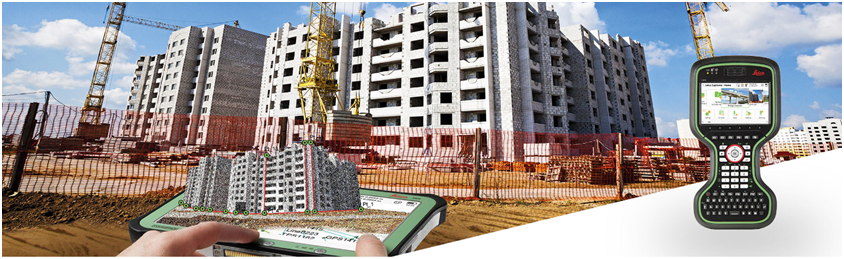
Leica Cyclone: 3D Point Cloud Processing Software


For organisations who need to add point cloud data to their process, the Leica Geosystems HDS™ total point cloud solution is the only solution that can create all of the deliverables you need. Unlike other scanning providers, our product efficiently delivers on the entire set of project requirements; which insures your organisations profitability.

The Leica Cyclone family of products are a key part of the total solution. The various Cyclone modules take users from start to finish for every type of point cloud project.

There are modules to take advantage of the unique Leica Geosystems scanners field data collection operations such as traverse, back-sight, and resection for rich survey grade collection and registration of the data. This includes wizard like automation routines that do all the work for the user as well as the industries richest set of QA/QC and survey adjustment and analysis tools.

There are other modules dedicated to generating a vast array of deliverables from reports, to maps and 3D models, movies/animations and light weight 3D data formats that can be distributed freely over the web. These modules support a wide range of industries and workflows including civil engineering, as-built 3D models, topographic surveys, BIM models and much much more.

Leica Cyclone is comprised of individual software modules for different needs and for flexible product deployment:
Leica Cyclone & NCTech iSTAR panoramic camera
Leica Geosystems now offers the iSTAR panoramic camera integrated with the HDS scanning workflow. Together, Leica Cyclone software and the iSTAR camera deliver high resolution HDR images, seamlessly improving field and office workflows for creating an immersive coloured point cloud.

For more details: Leica-geosystems.com / Video

Leica Viva GS15 – Versatility at its Best

From completely integrated to totally modular, the Leica Viva GS15 offers you the flexibility to choose which wireless communication device best meets your needs now and in the future. These devices are supported by intenna technology - a fully-integrated antenna concept. This smart antenna adjusts to any environment and delivers the most accurate results.

Eliminate downtime and work as you want with the ability to switch out batteries without powering down. Providing twice the operation time, the Leica Viva GS15’s dual battery option, integrated antenna and exchangeable communication devices are the best elements for a completely versatile GNSS system. 

The Leica Viva GS15 smart antenna also delivers with:

Engaging software
The Leica Viva GS15 GNSS smart antenna comes with the revolutionary Leica Captivate software, turning complex data into the most realistic and workable 3D models. With easy-to-use apps and familiar touch technology, all forms of measured and design data can be viewed in all dimensions. Leica Captivate spans industries and applications with little more than a simple swipe, regardless of whether you work with GNSS, total stations or both.

Seamless data sharing
Leica Geo Office imports and combines data from your GNSS, total station and level instruments for one final and accurate result. Processing has never been made easier when all your instruments work in tandem to produce precise and actionable information.   

Customer care at a click
Through Active Customer Care, a global network of experienced professionals is only a click away to expertly guide you through any problem. Eliminate delays with superior technical service, finish jobs faster with excellent consultancy support, and avoid costly site revisits with online service to send and receive data directly from the field. Control your costs with a tailored Customer Care Package, giving you peace of mind you’re covered anywhere, anytime.

Powerful handheld devices
In a controller or a tablet, take your entire office on the go when you discover the power to overcome any environment from the palm of your hand.  The Leica CS20 controller and Leica CS35 tablet provide the ultimate in control and convenience with complete mobility. Touch screen technology allows for comfortable and quick data processing while a stunning 3D view transforms your Leica Viva GNSS experience.

For more details: Leica-geosystems.com / Video

Leica Viva TS16


Meet the world’s first self-learning total station. Automatically adjusting to any environmental conditions, the Leica Viva TS16 locks onto your, and only your, target. Regardless of how challenging the task or the amount of distractions in the field, this total stations exceeds your expectations.
Cover a wide range of applications when this total station sees precisely what you see. Known for the most comprehensive imagining capability available, you can capture exact conditions for any worksite through the self-learning capability of the Leica Viva TS16.
With the Leica Viva TS16, you also receive:
  • Engaging software
    The Leica Viva TS16 Total Station comes with the revolutionary Leica Captivate software, turning complex data into the most realistic and workable 3D models. With easy-to-use apps and familiar touch technology, all forms of measured and design data can be viewed in all dimensions. Leica Captivate spans industries and applications with little more than a simple swipe, regardless of whether you work with GNSS, total stations or both.
  • Infinite possibilities
    While Leica Captivate captures and models data in the field, Leica Infinity processes the information back in the office. A smooth data transfer ensures the project stays on track. Leica Captivate and Leica Infinity work in conjunction to join previous survey data and edit projects faster and more efficiently.
  • Customer care at a click
    Through Active Customer Care, a global network of experienced professionals is only a click away to expertly guide you through any problem. Eliminate delays with superior technical service, finish jobs faster with excellent consultancy support, and avoid costly site revisits with online service to send and receive data directly from the field. Control your costs with a tailored Customer Care Package, giving you peace of mind you’re covered anywhere, anytime.
  • ATRplus
    ATRplus, born from five generations of optimisation, takes known and trusted automation performance to the next level. This superior technology maximises the total station’s ability to remain locked on your target, ignoring other distractions in the field. The Leica Viva TS16 learns the environment, delivers accurate positions even in difficult dynamic applications, and offers the fastest re-lock in case of interrupted line of sight.
For more details: Leica-geosystems.com /  Video

Leica Nova MS60 – The new experience in measuring technology

To meet the demands of our ever-changing and increasingly-quicker world, we developed the world’s first MultiStation, combining all available measurement technologies in one superior instrument. Now, we’ve made that instrument even smarter. The Leica Nova MS60 MultiStation is the world’s first self-learning MultiStation, automatically and continuously adapting to any environment, despite any challenges.
Scanning with the Leica Nova MS60 has been made simpler through the instant creation of point clouds with overlaid measured points and 3D models in one view. Visualisations are clearer and easier to see on an all-new 5” screen.
The unique capabilities of the Leica Nova MultiStation truly deliver the new experience in measuring technology.
The Leica Nova MS60 MultiStation also delivers with:
  • Engaging software
    The Leica Nova MS60 MultiStation comes with the revolutionary Leica Captivate software, turning complex data into the most realistic and workable 3D models. With easy-to-use apps and familiar touch technology, all forms of measured and design data can be viewed in all dimensions. Leica Captivate spans industries and applications with little more than a simple swipe, regardless of whether you work with GNSS, total stations or both.

  • Infinite possibilities
    While Leica Captivate captures and models data in the field, Leica Infinity processes the information back in the office. A smooth data transfer ensures the project stays on track. Leica Captivate and Leica Infinity work in conjunction to join previous survey data and edit projects faster and more efficiently.

  • Customer care at a click
    Through Active Customer Care, a global network of experienced professionals is only a click away to expertly guide you through any problem. Eliminate delays with superior technical service, finish jobs faster with excellent consultancy support, and avoid costly site revisits with online service to send and receive data directly from the field. Control your costs with a tailored Customer Care Package, giving you peace of mind you’re covered anywhere, anytime.

  • Customisable packages
    A portfolio of intuitivie software for any application gives you the freedom to choose how you want to work. Leica MultiWorx for AutoCAD, Leica Cyclone, Leica GeoMos, Leica Infinity, various Hexagon software packages and selected partner third-party software can be integrated into your workflow to create the customised solution for your specific need. Whatever you choose, you’ll enjoy an immersive experience that goes well beyond the data.

For more details:  Leica-geosystems.com / Video

Leica Captivate: Be Captivated

Software with familiar apps and easy-to-use touch technology
Leica Captivate is a industry-revolutionising software for a variety of measurement instruments, including MultiStations and total stations, that creates the most realistic 3D renderings with familiar apps and easy-to-use touch technology.
With Leica Captivate onboard, experience the all-encompassing solution of:
  • A new generation of Leica Nova and Viva Total Stations and MultiStation with ATRplus, the world’s first self-learning total stations and MultiStation
  • Mobile power in your hands with the new Leica CS20 remote and Leica CS35 tablet installed with Leica Captivate for an enjoyable experience on the go
  • Familiar apps and easy-to-use touch technology to create the most accurate and realistic 3D renderings of any jobsite
  • Leica Geosystem’s trusted services with a global support network of online and professional team assistance available anywhere, anytime
Incredibly easy software, instruments you trust, help that is only a click away – these combine to form the all-encompassing solution of the Leica Captivate Experience for your most challenging demands.

For more details: Leica-geosystems.com / Videos

Monday 14 March 2016

Leica MultiWorx for AutoCAD


Fast, easy point cloud processing of Leica Nova MS60 laser scan data
Leica MultiWorx for AutoCAD is for point cloud processing newcomers using Leica Nova MS60's integrated laser scanning capability. This plug-in for AutoCAD and Civil 3D lets drafters and designers work with rich, 3D point clouds in a familiar CAD environment. It also provides simpler and more powerful tools for navigating point clouds and creating deliverables than native CAD capabilities. 

The tools you need to quickly get it right
Leica MultiWorx for AutoCAD makes it easy to create accurate deliverables. True Colour images from Leica Nova MS60, aligned to scans, provide powerful visual context. Intuitive orientation tools make working in 3D easy. Versatile clipping tools make subdividing scans into areas of interest fast and accurate. A robust set of «Virtual Surveying» features make accurate topographic drafting simple and fun. 
 
Scan capabilities for a wide variety of applications
Take advantage of Leica Nova MS60's scan capabilities. Whether you're using Leica Nova MS60's scanning capabilities for specific survey tasks or as valuable project QA, Leica MultiWorx lets you take full advantage of Leica Nova MS60's rich point clouds and images to create better maps, profiles & cross-sections, contours, facade drawings, quantity surveys, as-built & detail surveys, and more. 

Richer results from familiar workflows
Using traditional total station set up and traverse methods, Leica Nova MS60 also collects rich point clouds and informative images. In the office, simply adjust the field data using Leica Infinity or any other tool you prefer. Then, inside AutoCAD or Civil 3D, Leica MultiWorx lets you create even better, «higher-confidence» traditional deliverables. 

Leica MultiWorx key features
  • Integrated ribbon interface provides access to all MultiWorx commands in familiar AutoCAD\Civil 3D style
  • User can select point cloud colourisation settings. This CAD window shows the point cloud in intensity Multi-Hue\Rainbow
  • Panoramic TruSpace window includes background imagery from Leica Nova MS60 internal camera for increased comprehension
  • In addition to the background images, the TruSpace window is showing the point cloud with the True Colour setting
  • TruSpace window can be linked to the CAD window and used to easily manipulate the 3D viewpoint

Leica MultiWorx main features

Point Cloud Management
  • Simplified opening of point cloud data; 3D limit boxes, slices, interactive visualisation of all size data sets
Visualisation
  • Intensity mapping, true colour; limit boxes, slices
  • TruSpace panoramic viewer: Select view point from keyplan; Drive CAD viewpoint from TruSpace; Quick limit box in CAD from single pick; Send point picks from TruSpace to CAD command; Includes background images
Rendering
  • Level of Detail (LOD) graphics, «Single pick» point cloud density control
Drafting support
  • Automatically orientate UCS to walls and floors; UCS Orientation Support with a few simple picks on the point cloud; High point, low point and ground point SmartPick Snapping; Creation of COGO points on a user specified Points on a Grid; Project linework to Workplanes.
For more details: Leica-geosystems.com / Video
 

Thursday 10 March 2016

Leica ScanStation P40 / P30 - Because every detail matters

The Leica ScanStation P40 / P30 deliver highest quality 3D data and HDR imaging at an extremely fast scan rate of 1 mio points per second at ranges of up to 270 m. Unsurpassed range and angular accuracy paired with low range noise and survey-grade dual-axis compensation form the foundation for highly detailed 3D colour point clouds mapped in realistic clarity. 
 
The right choice
Whether capturing 3D geometry of civil infrastructure, creating an as-built representation of a large industry complex, reconstructing a crime scene or generating 3D data for integration into Building Information Modelling (BIM), you know you’ll need an accurate long range scanning tool for your projects – the new ScanStation P40 and P30 laser scanners from Leica Geosystems are the right choice, because every detail matters. 


High performance under harsh conditions
The Leica ScanStations deliver highest quality 3D data and HDR imaging at an extremely fast scan rate of 1 mio points per second at ranges of up to 270 m. Unsurpassed range and angular accuracy paired with low range noise and survey-grade dual-axis compensation form the foundation for highly detailed 3D colour point clouds mapped in realistic clarity. 


Reduced downtime
The extremely durable new laser scanners perform even under the toughest environmental conditions, such as extreme temperatures ranging from – 20°C to + 50°C and comply with the IP54 rating for dust and water resistance. 


Complete scanning solution
Leica Geosystems offers the new Leica ScanStation portfolio as an integrated part of a complete scanning solution including hardware, software, service, training and support. 3D laser scanner data can be processed in the industry’s leading 3D point cloud software suite, which consists of Leica Cyclone stand-alone software, Leica CloudWorx plug-in tools for CAD systems and the free Leica TruView.

For more details: Leica-geosystems.com / Video

Wednesday 9 March 2016

Trimble RealWorks


Trimble 3D scanning software allows you to integrate 3D point and survey data to Extract measurements, Generate deliverables and Utilize inside 3D CAD software. 

Trimble RealWorks Software for 3D Scanning Professionals
Trimble RealWorks is specifically designed for point cloud processing and analysis. The software provides a complete solution to efficiently register, analyze, model and create deliverables using data from virtually any source.
  • Comprehensive, industry-leading point cloud processing and production software
  • Automated registration supports both target-based and targetless workflows
  • Advanced data management can handle large datasets to take full advantage of modern high-speed laser scanners
  • Support for most standard point cloud file formats
  • Quickly publish projects for sharing and collaboration
  • Powerful fitting tools and SketchUp Pro interoperability provide fast, accurate modeling to the point cloud
  • Application-specific tools such as the Advanced Storage Tank edition streamline modeling and analysis to deliver significant time savings

To try Trimble RealWorks for yourself, download the Trimble RealWorks Viewer, a complimentary Trimble utility. Trimble RealWorks Viewer also gives your colleagues, partners, and clients the ability to view and manipulate 3D deliverables in the native Trimble RealWorks environment.

For more details: Trimble.com
 

Trimble CenterPoint RTX


CenterPoint® RTX, Trimble RTX's premier correction service, provides accuracy better than 4 cm (1.5") via satellite or cellular. No other satellite delivered correction service performs better.


  • Availability: Worldwide
  • High Accuracy: Provides < 4 cm (1.5") horizontal accuracy(All horizontal accuracy specifications are based on in-field performance 95% of the time.)
  • Quick initialization: CenterPoint RTX converges to full accuracy in 1-5 minutes in select regions, and less than 30 minutes worldwide, (see coverage map for details)
  • Multi-constellation support: GPS, GLONASS and QZSS enabled
  • More uptime: Continue working through correction signal interruptions for up to 200 seconds
  • No base station required: No longer worry about losing radio signal connectivity since a base station is not required for Trimble RTX-based correction services
  • Cost Effective: No additional data or cellular plans required
  • Fast Restart (Agriculture) and Quick Start (Survey): Decrease the standard** initialization time to less than 5 minutes at the beginning of each day by starting your tractor in the same place you shut it off the night before
  • Benefit for farming: Achieve greater productivity in the field when planting, spraying or spreading. High accuracy, Trimble CenterPoint RTX, can reduce overlap by 90% - 95%. This equates to up to a 5% savings on input costs.

For more details: Trimble.com / Video (2mn)

Trimble Business Center & Inpho UASMaster


Trimble business center common workflows:
  • Control Surveying: Confidently produce reliable control coordinates combining total station, level and GNSS data in robust network adjustment
  • Field to Finish: Easily create CAD-ready deliverables directly from survey data.
  • GIS Feature Collection: Expand the utilization of your survey systems by creating GIS deliverables for your clients.
  • Construction Staking: Prepare design data for stakout with Trimble Access or Machine Control and verify as-staked information with ease
  • Integrated Aerial and Terrestrial Photogrammetry: Process complete mapping projects that include UAS and Trimble VISION imagery, GNSS and total optical observations.
For more details: Trimble.com
 
INPHO is a reliable, competent photogrammetric system. It offers a full line of innovative, world-class products for capturing and processing geospatial data and covers the entire digital photogrammetric workflow, from geo-referencing all the way through to orthophoto mosaicking and stereo plotting. With thousands of implementations, Inpho software is in use globally to standardize and enhance image data for national mapping, forestry, agriculture, mining, utility and energy, urban development, defense and disaster response.
  • Modern computer-vision algorithms combined with proven state-of-the-art photogrammetric techniques produce accurate results automatically, with minimal manual interaction:
  • Intuitive guided workflow concept even suited for the photogrammetric novice which perfectly integrates interactive context-driven and automated editing capabilities for geo-referencing and point clouds including morphological data creation (e.g. break-line measurements), classification, filtering, and many more.
  • Open for any fixed-wing, helicopter-type or other UAS hardware. The technology is optimized for UAS with GPS support (recommended accuracy ±10 m)
  • Fully compatible with Inpho photogrammetry modules from Trimble
  • Software rental: UASMaster is also available for rental on a monthly basis
INPHO software is designed to process complicated photogrammetry projects with the volume of a block more than 20 000 images.

For more details: Trimble.com

Trimble V10 Imaging Rover : Positions from Pictures

The Trimble V10 Imaging Rover with Trimble VISION™ technology is an integrated camera system that precisely captures 360-degree digital panoramas for efficient visual documentation and measurement of the surrounding environment. As a complete system solution, the Trimble V10 enables you to capture more critical information that can be transformed into enhanced, rich geospatial deliverables. With the Trimble V10, a picture is worth a thousand points.

Rapid Data Capture – Trimble VISION at the rod: 
The Trimble V10 featuring Trimble VISION technology allows you to capture a 60 MP panorama image with the simple push of a button.
  • A total of 12 calibrated cameras – seven panorama and five downward-looking – provide complete site documentation that can be used to make photogrammetric measurements
  • Integrates seamlessly with the Trimble R-series GNSS receivers, Trimble S-series total stations, and VX spatial station
  • Capture panoramas, review images and store observations using Trimble Access field software
  • High dynamic range (HDR) imagery improves image quality, even when you are working in variable light conditions
Capture Everything Now, Measure Later :
Avoid site rework and benefit from increased quality control and data validation by capturing data now and measuring later.
  • In the field, use the V10 visually observe and capture the entire job site
  • In the office, Trimble Business Center offers close-range photogrammetry tools to perform survey-grade measurement of imaged features and prepare rich deliverables
  • Export collected images into SketchUp Pro to create robust 3D models of buildings, bridges and a variety of other objects

Point Clouds and 3D Models From Pictures :
Generate very dense point clouds from terrestrial panorama data to achieve an accurate 3D representation of a site. Use the data for area and volume computations, linear measurement, and terrain modeling.
Images captured with the powerful Trimble V10 Imaging Rover can be exported into SketchUp to create robust 3D models of buildings, bridges and a variety of other objects for faster deliverable generation. 

Use Standalone:
The Trimble V10 can be used without an external positioning sensor. This is ideal in applications such as interior mapping, bridge inspection, and crime and crash scene investigation for both geospatial and non-geospatial professionals. 
For more details: Trimble.com / Video (2mn)


Trimble S7 Total Station


The Trimble S7 Total Station combines scanning, imaging and surveying into one powerful solution. Now you only need one instrument on the job site to perform all your data capture. Create 3D models, high accuracy visual site documentation, point clouds, and more using the Trimble S7, Trimble Access™ field software and Trimble Business Center office software. 

Manage Your Assets 24/7
Know where your total stations are 24 hours a day with Trimble Locate2Protect technology.See where your equipment is at any given time and get alerts if your instrument leaves a jobsite or experiences unexpected equipment shock or abuse.


Trimble InSphere™ Equipment Manager system lets you view usage and keep up-todate on firmware, software and maintenance requirements. With Trimble Locate2Protect and InSphere Equipment Manager, you can rest assured knowing your equipment is up-to-date and where it should be.

For more details: Trimble.com / Video (2mn)

Trimble S8 Total Station


The Most Advanced Total Station Platform:
The most demanding jobs require the most advanced total station in the industry. Whether you need solutions to drive productivity for day to day survey tasks or precision solutions for demanding engineering projects, the Trimble S8 is the most advanced total station solution available today. You can do more and do it better with the most innovative and advanced total station available today. 

The new Trimble S8 Total Station provides a broad base of standard inclusions and configuration options for unmatched flexibility. 


Trimble VISION Video-Assisted Control :
With Trimble VISION™, see everything the instrument sees without a trip back to the instrument
  • Select targets with just a tap of the controller screen
  • Measurements are drawn to the video image, so you can be certain to never mess a shot you need
Video-Assisted Documentation:
Leave the site with more than just coordinates. With the Trimble S8, live images are captured with point-and-click efficiency.
  • Document important visual information like site conditions and details
  • Easily recall what was at the scene
Trimble FineLock Technology:
Detect target without interference from surrounding prisms for precision-build applications 

For more details: Trimble.com

Trimble S6 Total Station

Total Performance in Servo, Autolock and Robotic Technolog:

The Trimble® S6 Total Station provides the power and flexibility required by today's surveying professionals.

Trimble VISION Video-Assisted Contro:
Now available with Trimble VISION™ technology, the Trimble S6 Total Station enables surveyors to remotely see and measure through a live video feed from the instrument on their data controller.
  • See everything the instrument sees without a trip back to the office.
  • Select targets with just a tap of the controller screen.
  • Measurements are drawn to the video image, so you can be certain to never miss a shot you need.
MagDrive Servo Technology:
The Trimble S6 Total Station redefines surveying instrument performance with unsurpassed integration of servos, angle sensors and measurement technology.
  • Advanced error compensation provides fast, accurate measurement.
  • Capable of changing face at lightning speed and turning 115 degrees per second
Trimble SurePoint Technology:
Trimble SurePoint provides automatic compensation for minor movements from wind, weather, and sinkage.
Ensures accurate pointing and measurement every time. Reduce aiming error. 

For more details: Trimble.com / Video (2mn)

Surveying Without Boundarie, Trimble R10 GNSS System


With the Trimble R10 GNSS System, survey previously inaccessible points, reduce occupation time and record faster and safer measurements than ever before. Built-in firmware gives automatic compensation for up to 15 degrees

The Trimble R10 GNSS system, together with the Trimble Access field software and the Trimble Business Center office software, provides the most advanced GNSS surveying system on the market.

Collect more accurate data faster and easier – no matter what the job or the environment, with the Trimble® R10 GNSS System. Built with powerful technologies like Trimble HD-GNSS, Trimble SurePoint™, Trimble CenterPoint™ RTX, and Trimble xFill™, integrated into a sleek design, this unique system provides Surveyors with a powerful way to increase productivity in every job, every day. 

Features
  • Trimble xFill™ provides less downtime in the field, with continuous RTK coverage during connection outages from an RTK base station or VRS network.
  • Trimble CenterPoint™ RTX™ delivers GNSS corrections via satellite or internet connection anywhere in the world for unprecedented speed and accuracy for a PPP solution.
  • Cutting edge Trimble HD-GNSS processing engine enables surveyors to measure points more quickly.
  • Trimble SurePoint™ fully compensates for pole tilt. Conveniently measure points that were otherwise inaccessible with complete quality assurance.
  • Powerful 440-channel solution with Trimble 360 technology delivers the most advanced satellite tracking.
  • Ergonomic design for easier and more comfortable handling.
  • Integrates seamlessly with V10 Imaging Rover and S-Series total station (S8, S7, S6, ...) positioning sensors.
  • Pair with Trimble Access and the TSC3 controller, Trimble Tablet, Slate or Trimble CU for the most powerful solution on the market.

For more detail : Trimble.com / Video N°01(1mn) & Video N°2(01 hour)

Trimble ZX5 Multirotor Unmanned Aircraft System

The Trimble ZX5 is another accurate, reliable tool in Trimble’s family of UAS solutions. Fast to setup and easy to operate, the Trimble ZX5 allows you to quickly collect data in the field so you can generate the dynamic deliverables required for today’s jobs. It requires no launcher, is easy to deploy and includes everything you need to capture high quality georeferenced photos for applications such as aerial mapping and inspections.
  • Vertical takeoff and landing capability allows users to work in tight places and obstructed environments where fixed wing solutions are less suitable.
  • The system can be equipped to capture live video imagery for inspection applications such as civil infrastructure, utilities, and oil and gas pipelines.
  • Simple field-to-office workflows ensure reliable results
  • Easily integrate with other Trimble technology
Image Processing

Import your data into Trimble Business Center Photogrammetry Module office software to create detailed orthophotos, digital elevation models, point clouds, volume calculation, 3D models and more without requiring specialized photogrammetry knowledge or experience. Or utilize the state-of-the-art Trimble Inpho UASMaster module for advanced photogrammetric processing.

Fore more details: Trimble.com / Video (1mn)

Trimble UX5 HP Unmanned Aircraft System

The Trimble UX5 HP is a professional aerial mapping system, designed to capture the highest image accuracy for survey applications. The features of the new UX5 High Precision will include an integrated Trimble GNSS receiver, a powerful new camera, and a selection of camera lenses for the ultimate in system flexibility. Users can now configure their system for high-precision or increased flight coverage based on project needs.
  • Orthomosaics resolution down to 1 cm & 3D models with up to 1,000 pts/m2
  • 36 MP, full frame sensor camera ensure better quality images in low light or high contrast situations, allowing in more light and less noise for a greater dynamic range .
  • Flexibility to choose between a near infrared or RGB sensor system, and a selection of lenses.
  • Capture the highest quality data in difficult conditions
  • Survey quality accuracy without ground control
  • Utilization of PPK GNSS technology to establish image location, ensures time savings in the field.
Trimble Access Aerial Imaging Application
The Trimble Access™ Aerial Imaging application loaded onto the Trimble Tablet Rugged PC operates the Trimble UX5 HP and is a single software tool for planning your aerial missions, performing pre-flight checks and monitoring your flights.
  • Intuitive workflows ensure reliable results.
  • Simple User Interface supports all of the functionality
  • Conduct flights in a fully automated manner, from launch to landing
  • No piloting skills required
  • Built-in safety procedures ensure safe and successful launches each time
  • Easily map corridors, import multiple map layers, fly irregular shaped areas and heights
Image Processing
The Trimble UX5 HP aerial image data can be processed into powerful deliverables with the Trimble Business Center (TBC) photogrammetry module. Specialized computer-vision algorithms produce very accurate results automatically, with minimal manual interaction. Provides a stable and reliable photogrammetric system delivering excellent results without requiring specialized photogrammetry knowledge or experience. Alternatively, Inpho UASMaster provides the power user or photogrammetrist with the right set of tools to use the full potential of aerial data. 
For more details: Trimble.com / Video (2mn)


Trimble xFill

    Trimble xFill runs seamlessly in the background automatically bridging the gap if a users RTK or VRS correction source is interrupted due to cellular signal disruption or loss of radio connectivity
    Powered by Trimble RTX technology, Trimble xFill leverages real-time data from a global tracking station network along with innovative positioning and compression algorithms to compute and relay satellite orbit, satellite clock, and other systems adjustments to the receiver, resulting in the real time high accuracy positions. These adjustments are transmitted to the receiver via satellite (where coverage is available).
    When turned on, the receiver tracks the RTX (L-band) satellite as well as every satellite in its field of view including, GPS, GLONASS, BeiDou and QZSS satellite constellations. From the L-band satellite, you will receive the RTX real time correction stream that allows you to calculate your position to high accuracies, without the need of a base station.

  • Standard xFill: Free for the first 5-20 minutes (application dependent) after the loss of an RTK correction source on all compatible devices
  • Enhanced xFill: Works indefinitely on the Trimble R10 GNSS System and Trimble NetR9s Geospatial receiver with a valid CenterPoint RTX subscription

    For more details: Trimble.com

Tuesday 8 March 2016

Land/geomatics surveyors

Land/geomatics surveyors measure and collect data on specific areas of land, including information about boundaries, buildings and features, both natural and man-made.
Geomatics is one of the most technologically advanced of the surveying specialist roles and has a key function in a diverse range of sectors, including: 
  • cartography
  • construction
  • geographical information systems
  • property
  • Offshore engineering and exploration.
  • Land/geomatics surveyors assess land due for redevelopment and survey a range of different areas, including airports, landfill sites, mines and quarries and pipeline and distribution systems.
The term 'geomatics' tends to be more commonly used than 'land surveying' in the industry. 

Responsibilities:
Tasks carried out by a land/geomatics surveyor vary depending on the area they are working in but can include:
  • making use of geographical information systems (GIS) to analyse and interpret site features;
  • producing detailed information (subsequently analysed by planners, builders and cartographers);
  • using a range of equipment to produce surveys, including GPS and conventional methods;
  • analysing information thoroughly before it is handed over to other professionals;
  • measuring the ground, including aspects such as small and large-scale distances, angles and elevations;
  • gathering data on the earth's physical and man-made features through surveys;
  • processing data;
  • undertaking digital mapping;
  • thinking creatively to resolve practical planning and development problems;
  • interpreting data using maps, charts and plans;
  • utilising data from a range of sources, such as aerial photography, satellite surveys and laser beam measuring systems;
  • using computer-aided design (CAD) and other IT software to interpret data and present information;
  • keeping up to date with new and emerging technology;
  • Providing advice to a variety of clients.
Surveyors who have chartered status are more likely to be involved in the managing and monitoring of projects from start to finish. 

Refer to : Prospects